Good news! But better forecasting of wildfires is no substitute for better management of forests/wildlands to prevent wildfires!
Not climate change, but failure of proper forest/wildland management, arson, and other human activities are the cause of most wildfires.
"Key takeaways:
- In validation tests using data from two of California’s most intense recent wildfires — the Dixie and Caldor fires of 2021 — FuelVision’s predictions closely matched actual fuel maps.
- FuelVision operates autonomously, utilizing commonly available data.
- Because it draws data from global satellite inputs, FuelVision is readily adaptable to forested areas nationwide.
..."
From the highlights and abstract:
"Highlights
• Near real-time wildland fuels mapping algorithm.
• Leverage satellite remote sensing data and terrain features.
• Overcome challenge posed by imbalanced datasets.
• Leverage General Adversarial Networks for synthetic remote sensing data generation.
Abstract
Accurate assessment of fuel conditions is a prerequisite for fire ignition and behavior prediction, and risk management.
The method proposed herein leverages diverse data sources – including L8 optical imagery, S1 (C-band) Synthetic Aperture Radar (SAR) imagery, PL (L-band) SAR imagery, and terrain features – to capture comprehensive information about fuel types and distributions.
An ensemble model was trained to predict landscape-scale fuels – such as the ’Scott and Burgan 40’ – using the as-received Forest Inventory and Analysis (FIA) field survey plot data obtained from the USDA Forest Service.
However, this basic approach yielded relatively poor results due to the inadequate amount of training data.
Pseudo-labeled and fully synthetic datasets were developed using generative AI approaches to address the limitations of ground truth data availability. These synthetic datasets were used for augmenting the FIA data from California to enhance the robustness and coverage of model training.
The use of an ensemble of methods – including deep learning neural networks, decision trees, and gradient boosting – offered a fuel mapping accuracy of nearly 80%. Through extensive experimentation and evaluation, the effectiveness of the proposed approach was validated for regions of the 2021 Dixie and Caldor fires. Comparative analyses against high-resolution data from the National Agriculture Imagery Program (NAIP) and timber harvest maps affirmed the robustness and reliability of the proposed approach, which is capable of near-real-time fuel mapping."
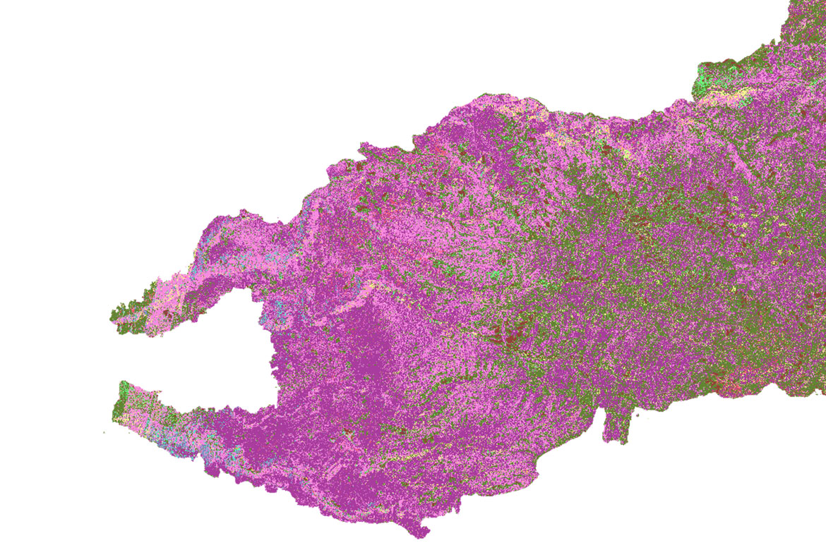
Fuels map of the 2021 Caldor Fire, as predicted by FuelVision
No comments:
Post a Comment